
San Diego’s Fault Lines
Welcome, fellow adventurers! If you’re like me, the natural wonders of our planet never cease to amaze you. Today, we’re diving into a topic that’s as fascinating as it is essential: San Diego’s Fault Lines. This journey will take us through the intricate web of seismic activity that shapes this beautiful region. So, buckle up because understanding the fault lines in San Diego is crucial not only for enthusiasts like us but also for the safety and preparedness of the community.
The Geology of San Diego: A Brief Overview
Before we delve into the fault lines themselves, it’s essential to get a grasp of the geological foundation of San Diego. Situated in the southwestern corner of California, San Diego lies on a complex network of tectonic boundaries. These geological structures are a result of the Pacific Plate sliding past the North American Plate, a dynamic interaction that has sculpted the landscape over millions of years.
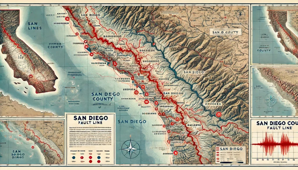
The Major Fault Lines in San Diego
San Diego’s seismic activity is primarily governed by several major fault lines. Understanding these fault lines can help us appreciate the region’s seismic behavior and prepare for potential earthquakes.
- The Rose Canyon Fault
- Running through the heart of San Diego, the Rose Canyon Fault is perhaps the most well-known. It stretches from La Jolla to downtown San Diego and is capable of producing significant earthquakes. Its proximity to populated areas makes it a focal point for seismic studies.
- The San Jacinto Fault
- Extending from the Inland Empire into San Diego County, the San Jacinto Fault is one of Southern California’s most active fault lines. It has a history of producing large earthquakes, making it a crucial element in understanding regional seismic risk.
- The Elsinore Fault
- This fault line runs from the Mexican border through Riverside and into San Diego County. It’s a major component of the fault system in Southern California and has the potential to cause substantial seismic activity.
- The Laguna Salada Fault
- Located in northern Baja California, the Laguna Salada Fault extends into southern San Diego County. Its activity can influence seismic events in the region, contributing to the overall seismic hazard.
Understanding Seismic Activity
Seismic activity refers to the frequency, type, and size of earthquakes experienced over a period in a specific area. In San Diego, the interplay of the aforementioned fault lines results in a complex pattern of seismic events. To understand this better, let’s break down the types of seismic activity:
- Microseisms: These are tiny earthquakes, often too small to be felt but detectable by seismographs. They occur frequently and provide valuable data on fault movement.
- Minor Earthquakes: Typically ranging from magnitude 3.0 to 4.0, these quakes are felt but rarely cause significant damage.
- Moderate Earthquakes: Magnitude 4.0 to 6.0 earthquakes can cause damage, especially in areas near the epicenter.
- Major Earthquakes: Magnitudes 6.0 and above can cause severe damage and are a primary concern for urban planning and emergency preparedness.
Historical Seismic Events in San Diego
Understanding the history of seismic activity in San Diego can provide context for future events. Here are some notable historical earthquakes that have shaped the region:
The 1862 San Diego Earthquake
One of the earliest recorded earthquakes in San Diego occurred on May 27, 1862. With an estimated magnitude of 6.0, this quake caused considerable damage to structures and was a wake-up call to the seismic potential of the area.
The 1986 North Palm Springs Earthquake
While not centered in San Diego, the 1986 North Palm Springs earthquake, with a magnitude of 6.0, was felt throughout the region. It highlighted the interconnected nature of fault lines in Southern California and the importance of regional seismic awareness.
The 2010 Baja California Earthquake
On April 4, 2010, a magnitude 7.2 earthquake struck northern Baja California, Mexico. This powerful quake was felt in San Diego and served as a stark reminder of the potential for significant seismic events originating outside the immediate area but still impacting the region.
The Science Behind Fault Lines
To truly understand San Diego’s fault lines, we need to delve into the science of tectonics. Fault lines are fractures in the Earth’s crust where blocks of land have moved past each other. This movement can be horizontal, vertical, or a combination of both. The energy released during this movement is what causes earthquakes.
Types of Faults
Faults can be classified into three main types, each with distinct characteristics:
- Strike-Slip Faults: These faults involve horizontal movement, where blocks slide past each other. The San Andreas Fault is a classic example of a strike-slip fault.
- Normal Faults: In these faults, one block moves downward relative to the other. They are common in areas experiencing extensional forces.
- Reverse (Thrust) Faults: Here, one block is pushed up relative to the other, typical in regions undergoing compressional forces.
San Diego’s fault lines primarily exhibit strike-slip and typical fault characteristics, contributing to the region’s complex seismic behavior.
Measuring Seismic Activity
Seismologists use various tools and techniques to measure and study earthquakes. Key instruments include:
- Seismographs: These devices record the motion of the ground during an earthquake. They provide critical data on the quake’s magnitude, depth, and location.
- GPS Stations: These stations measure the Earth’s surface movements with high precision, helping to track the slow build-up of stress along fault lines.
- InSAR (Interferometric Synthetic Aperture Radar): This remote sensing technology captures ground deformation over large areas, providing insights into fault movements and earthquake mechanics.
Preparing for the Big One: Earthquake Preparedness in San Diego
Living in an area with active fault lines means being prepared for earthquakes is essential. Here are some practical steps to ensure safety and readiness:
Build a Kit
Creating an emergency kit with essentials like water, food, medications, and first aid supplies can be lifesaving. Don’t forget to include a flashlight, batteries, and important documents.
Create a Plan
Having a family emergency plan is crucial. Ensure everyone knows what to do during and after an earthquake, including safe spots in your home and designated meeting points.
Secure Your Home
Take steps to make your home earthquake-resistant. This includes securing heavy furniture, installing latches on cabinets, and ensuring your home’s foundation is up to code.
Stay Informed
Keep up-to-date with the latest seismic activity and safety recommendations. Local authorities and organizations like the United States Geological Survey (USGS) provide valuable resources and updates.
The Role of Technology in Seismic Monitoring
Advancements in technology have significantly enhanced our ability to monitor and respond to seismic activity. In San Diego, several cutting-edge technologies are being utilized to improve earthquake preparedness and response.
Early Warning Systems
Early warning systems can provide crucial seconds to minutes of warning before an earthquake’s shaking begins. These systems detect the initial, less-damaging seismic waves and send alerts to give people and automated systems time to take protective actions.
Earthquake Simulation and Modeling
Scientists use advanced computer models to simulate earthquakes and predict their potential impacts. These simulations help in planning and designing structures that can withstand seismic forces, ultimately reducing the risk of damage and loss of life.
Community Involvement and Education
Educating the public about seismic risks and preparedness measures is a critical component of minimizing the impact of earthquakes. Community programs, workshops, and drills help residents understand what to do before, during, and after an earthquake, fostering a culture of preparedness.
Enhancing Your Knowledge of San Diego’s Seismic Activity
Understanding Fault Lines in San Diego
San Diego’s fault lines are a crucial aspect of the region’s geology. By understanding these fault lines, we can better prepare for potential earthquakes and mitigate their impact. Here are some key points to consider:
- San Diego Fault Lines: The Rose Canyon Fault, San Jacinto Fault, Elsinore Fault, and Laguna Salada Fault are the primary fault lines influencing seismic activity in the region.
- Seismic Activity: Regular monitoring and research are essential to understanding the patterns and potential risks associated with these fault lines.
- Earthquake Preparedness: Building a kit, creating a family plan, securing your home, and staying informed are vital steps to ensure safety during seismic events.
Why Knowing About San Diego’s Fault Lines Matters
Being informed about San Diego’s fault lines is not just about geological curiosity; it’s about being prepared and resilient in the face of natural disasters. Knowledge is power, and understanding the seismic activity in your area can make a significant difference in how you respond to and recover from earthquakes.
The Impact of Historical Earthquakes
Historical seismic events provide valuable insights into the behavior of fault lines and the potential risks they pose. By studying past earthquakes, scientists and residents alike can better anticipate future seismic activity and take proactive measures to reduce its impact.
Conclusion
As we conclude our journey through San Diego’s fault lines, it’s clear that understanding the region’s seismic activity is not only fascinating but also crucial for our safety and preparedness. By learning about the major fault lines, historical earthquakes, and the science behind seismic activity, we can better appreciate the dynamic nature of our planet and take informed steps to protect ourselves and our communities.
Remember, being prepared and staying informed are our best defenses against the unpredictable nature of earthquakes. So, let’s continue to explore, learn, and share knowledge about the incredible geological forces that shape our world.
Stay safe, fellow adventurers, and keep exploring!